 Surveying
Project
Surveying
ProjectA Broad Range of Successful Projects
Since 1977 we have completed thousands of professional surveys, constituting a broad range of projects in scope and size.
Extensive experience with Legal and Development Surveys for private landowners, commercial/industrial developments, mining resources, roadways and First Nations bands has made us the surveying company of choice in Northern Ontario.
A brief description of survey types and major completed projects are listed below.
 Legal
and Development Surveys
Legal
and Development SurveysThese surveys are carried under the Land Titles, Surveys, Registry and Surveyors Acts for the determination of property boundaries, both existing and newly created and the preparation of plans to be registered in the Land Registry Office based on research, field surveys and cadastral law.
These types of surveys are executed for small private landowners, commercial or industrial developments, and government agencies. These can include applications for the definition of existing lot boundaries, development of new lots, subdivisions, land acquisition and zoning by-law amendment, topographic, lot grading and drainage survey plans for development planning, construction and architectural designing, site monitoring, construction layout and final as-built site plans and/or commercial Surveyor’s Real Property Reports.
Aside from survey execution, our services can also include, map and plan rendering, research of old records, plans, air photos and title searches and/or consultation and representation where clients require a professional liaison when engaging local, municipal, provincial and federal Planning Committees.
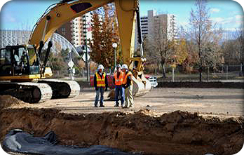
In the Construction industry, we have been involved in the layout of many diverse and complex projects.
Services we have delivered include topographical surveys for pre-engineering & design, review of architectural drawings to ensure that the building mathematically fits on the lot and meets zoning requirements.
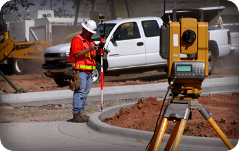
Our field survey experience includes layout of gridlines, layout of column centerlines and anchor bolts, monitoring of adjacent structures, and setting grades. Once the building is complete, we also carry out surveys for certification of compliance with specifications.
As well we have executed large scale Mapping and Control Survey projects utilizing vertical and horizontal control aerial photography to produce detailed elevation mapping required for various types of projects.
Projects
Subdivision Surveys - Barrie Ontario
Ontario Hydro & Hydro One - Engineering Surveys & Reference Plans for land acquisition & transfer of right of ways
Burwash Industrial Farm - Township boundary retracement surveys
College Boreal - Topographical, Legal Layout Certification
Laurentian Hospital & Cancer Treatment Center - Legal Layout
Consbec - Boundary survey, design & layout of estate waterfront lots
Dominion Park - Official plan amendment, rezoning & subdivision applications, survey design & layout of 600 lot subdivision in phases
Region of Sudbury - Legal surveys to acquire lands for road widening
Region of Sudbury - Three dimensional reference plan for drainage course under an existing building
Sudbury Millennium Center - Costco & Silver City Cineplex, Sudbury, legal surveys for land acquisitions, rezoning & official plan amendments, topographic survey, layout, & final as-built plans
Sudbury Millennium Centre - Home Depot, Sudbury, legal surveys for land acquisitions, construction layout, survey & calculate aggregate volumes
Sudbury Millennium Centre Site - Pier One, Montana’s Restaurant, Sears Whole Home, Home Sense, Kelsey’s Restaurant, layout, Reference Plans for land acquisition, ROW & area certificates
Canadian Tire - Topographic surveys, layout for new construction & building additions, final as built surveys at the Chelmsford, Sudbury Lasalle, Barrydowne and Hwy 69 South locations
Tim Hortons Sudbury - Legal surveys for land acquisitions, topographic surveys for design, site monitoring and final as built plans at the Sudbury Notre Dame, Barrydowne, Lorne, Hanmer, Garson, Azilda & Lively locations
Your Independent Grocer - Legal surveys for land acquisitions, topographic surveys & final as built surveys at the Hanmer RR#80, Sudbury Paris/Regent, Elm, Lorne St, Supermall Lasalle, Chelmsford, Espanola, Lively, Kirkland Lake & Sturgeon Falls locations
Petro-Canada - Reference Plans for land acquisition and rezoning, rock volume calculations & topographic surveys at seven Sudbury locations
Ontario Hydro - Legal survey at Atikokan Generating Station
Hanmer Valley Shopping Centre - Preparation of Reference Plan to consolidate numerous parcels in one holding
West Arm Lodge Inc - Lake Nipissing, Crown Lands Plan for land acquisition & final Surveyor’s Real Property Report
YWCA Sudbury (Genevra House) - Reference Plan for land acquisition & Site Plan for building layout/construction
Public Works & Government Services Canada - Taxation Data Centre, Topographic Plan & Commercial Surveyor’s Real Property Report
Vista Sudbury Hotel Inc. - Rainbow Centre, Sudbury, planning consultant services, Rezoning Application & Reference Plans
Greater Sudbury Airport - Eng. & Topographic Survey for new construction & design
Sal-Dan Developments - Rezoning & Subdivision applications, survey design & Draft Plan Of Subdivision, layout &Plan of 150 lot subdivision
Belanger Highway Maintenance - Engineering volume determination of MTO sand/salt stock piles at various yard locations & prepare volume plans
D.B.I. - Engineering volume determination of MTO sand/salt stock piles at various yard locations & prepare volume plans
 Mineral
Resources Surveys
Mineral
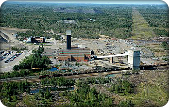
Resources SurveysWe have had extensive experience in the Mineral Resources industries working directly with the mine companies and their contractors, both above and below ground.
Mineral Resources Services include gyrotheodolite azimuth determination, automated laser tope surveys, pre-engineering surveys layout, location, construction and check surveys.
Above ground projects include preparing Applications and Site Plans for mineral extraction under The Aggregate Resources Act and consultation with the Ministry of Natural Resource’s staff on behalf of our clients.
Projects
Copper Cliff Smelter - FENCO Engineering Layout & Certification
Clarabelle Mill - Wright Engineers Engineering Layout & Certification
Creighton Deep Project - Underground 1.7km Spiral Ramp 7000-7400 level,Laser Tope, Design, Layout, 3 dimensional math model & CADD Plan
Coleman McCreedy Mine - Underground Check Surveys, Laser Tope, Layout
Crean Hill Mine - Underground Ramp Topo Survey & CADD Plan
Detour Lake Area - Mining Claim Surveys
Mining Claim Mapping Projects - Various Mining Camps in Northern Ontario
Falconbridge Nickel Rim Site Development - Layout & Check Surveys anchor bolts,main shaft head frame, winch house & layout sewage plant
River Gold Mine - Check Surveys & volume determination, Magnacon Mine, Wawa
Osprey Gold Corporation - Site Plan re-development of Jerome Mine Site, Sultan
Red Lake - MacIsaac Mining & Tunneling, Engineering Survey Layouts
Science North, Dynamic Earth Project / Big Nickel Mine Site - Mine Eng. Survey
Stillwater Mine, Montana USA - Moran Mining & Tunneling, Check Surveys
Sudbury Area Mine Projects - Stobie, South, North, Garson, Stathcona, & Fraser Mines, Mining Eng. Layouts, Check Surveys & Volume Determination
Hicks Construction Ltd. and Rainbow Concrete - Site Plans for new quarry
Hope Sand and Gravel - Site Plans to expand quarry
 First
Nation Projects
 We have also worked extensively with First Nations Indian Reserves throughout Ontario on various projects including land claim settlements, where new reserves are created or additional lands are being added to existing reserves.
Projects
Fort Albany First Nation - Right Of Way Survey
Dokis Indian Reserve - Subdivision & Right Of Way Surveys
Fort Albany First Nation - Kashechewan Band, Right Of Way Surveys
Nipissing First Nation - Subdivision Survey
Wikwemikong First Nation - Road & Lot Surveys
Moose Factory Island First Nation - Subdivision Surveys
French River & Henvey Inlet Indian Reserves
Webequie First Nation - Land claim survey 55 square km area
Point Grondine First Nation - Land Settlement Survey, Members of the Matinenda Lake Survey Group
Attawapiskat First Nation - Community Block Outline Survey
Nibinamik First Nation - Land claim survey 931 hectares area
Sandy Point and Rocky Bay First Nation - Lands claim survey 1700 hectares area
Attawapiskat First Nation Education Authority - School Site Survey
Attawapiskat First Nation - Crown Lands Acquisition (INAC)
Whitefish Lake First Nation - Subdivision & Right Of Way Surveys
Rainy Lake First Nation - Boundary Survey
McChigeeng First Nation - West Bay, Right of Way Survey
Serpent River First Nation - Road & Lot Surveys
Fort Severn First Nation - Boundary & Right Of Way Surveys
Magnetawan First Nation - Right of Way Survey
Washgoshing First Nation - Abitibi, Boundary Survey
Henvey Inlet First Nation - Boundary & Layout Water Treatment Plant Project
 Highway
and Route Surveys
Highway
and Route SurveysThese surveys are undertaken to gather pre-engineering information, layout of alignment, prepare plates and profiles and DTM's of both existing and proposed transportation facilities and preparation of Description Reference Plans, Crown Lands Plans and Expropriation Plans.
Projects
North Shore Group N.C. Gas Survey - Group member
INCO - Limited right-of-way & Control Surveys
Falconbridge Ltd. - Right-of-way & profile survey
Ministry of Transportation Ontario - Sudbury Southeast By-Pass
Town of Valley East - Cross Section of Whitson Lake Drive & preparation of Engineering drawings for construction
Falconbridge Route - Survey & profile of 13km future hydro pole line including road crossing cross sections
Ministry of Transportation Ontario - Engineering Survey, Highway 6, Espanola for Fenco MacLaren (WP 168-90-00)
Ministry of Transportation Ontario - Engineering survey, DTM, Highway 6 alignment marking for DF Elliot Engineering (Agreement 9850-7411-5307)
Ontario Northland - DTM, project control, layout for new railway spur line for Cole Sherman, Kapuskasing area
Ministry of Transportation Ontario - Layout of revised limits of 11 km of Highway 11 corridor in Nipigon - Land claim settlement, NRCan and MTO
Ministry of Transportation Ontario - Determine the as built alignment & prepare the required legal surveys, Highway 637, NRCan and MTO
Union Gas - Establish limits of right of way & prepare Crown Land Plans for high pressure gas line, Kapuskasing area
Ministry of Transportation Ontario - Engineering survey & land acquisition, Hwy 69 South project - Cole Engineering
Ministry of Transportation Ontario - Land Registry title searching & landowners list for future proposed road widening - Marshall Macklin Monaghan Ltd.
Ministry of Transportation Ontario - Engineering survey, highway 24, City of Brantford for MTO (Agreement No. 3005-A-000143, W.P. 347-97-00)
Ontario Northland - Engineering, GPS mapping & Crown Plans - Cole Engineering on behalf of Ontario Northland Opasatika Spur Line, Agrium Mine
Need more information?
Click here to contact
us now.